Accessible route map released to help people with physical disabilities navigate sections of Lawrence Loop

In this file photo from June 23, 2017, Staci Burch, of Lawrence, and Mark Patterson, of Overland Park, enjoy a walk along the Burcham Park Trail with Burch's dog Zara.
Friends of Lawrence Area Trails has released an accessible route map for the still-in-progress Lawrence Loop, which aims to highlight five sections of the trail that may be best suited for those using a wheelchair or another assistive device or for trail users generally looking to avoid steeper terrain.
Along with “easy,” “moderate” and “hard” ratings based on physical observations of the terrain in each section, the map also includes information about parking, nearby public transit stops and accessible amenities like benches located along the routes.
FLAT’s accessible routes, ordered by difficulty rating, are as follows:
• Burcham Park Route: “easy,” 0.5 miles one way. This section of the Lawrence Loop is wooded and flat, running alongside the Kansas River. It comes to an end at a rail crossing, where it’s possible to cross the tracks and enter Constant Park to access downtown.
• South Lawrence Trafficway Route (from the Lawrence Arboretum): “easy,” 1.5 miles one way. The trail west from the arboretum takes trail users through a meadow with bluffs to the north and branches after 1.5 miles. At that point, trail users can either stay on the Lawrence Loop and head north as the trail begins climbing or they can cross the road toward the base of Sanders Mound.
• Burroughs Creek and Haskell Rail Route: “moderate,” 1.75 miles one way. The trail runs from 11th Street to 29th Street on Lawrence’s east side and was rated “moderate” because there are a number of street crossings up to 23rd Street, some of which have steep curb ramp transitions. The Haskell section doesn’t have a large number of street crossings, but it doesn’t have water fountains or benches.
• South Lawrence Trafficway Route (from Baker Wetlands): “moderate,” 2 miles one way. This segment of the trail has little vehicle traffic and was rated “moderate” because it includes gentle, short, up-and-down slopes.
• Rock Chalk Park and Baldwin Creek Route: “hard,” 2 miles one way. These trail sections descend into a valley and level out at Queens Road. The second half of the return route includes a steady climb with short, steep sections, leading to its “hard” rating.
Physical copies of the accessibility guide are available at Independence Inc., the Senior Resource Center of Douglas County and the Lawrence Public Library. The map can also be printed on FLAT’s website.
Once completed, the Lawrence Loop will encompass a roughly 22-mile continuous trail circling the city. As of the first half of 2022, more than 18 miles of the Loop are completed and currently in use. Most recently, construction began on a section of the trail in northern Lawrence at the beginning of February.
Visit lawrenceks.org/loop for details about negotiating the incomplete sections that remain between the accessible sections identified along the trail.
Other News

Lawrence school district will soon implement changes to its cellphone, electronic devices policy to comply with state law
After an especially difficult year of trauma and bullying, a Lawrence teen gets a dream gift
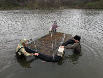
Prairie Park’s artificial floating island is cleaning the water and hosting all kinds of wildlife

Farmland’s legacy: How what used to be the largest farmer-owned co-op left contaminated sites in Lawrence and beyond
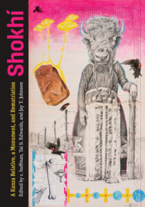
New book to reflect on lessons from project that returned sacred boulder to Kaw Nation