Organizers for proposed trail system north of I-70 in Lawrence say government agreement on easement is crucial
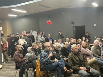
photo by: Bremen Keasey
Around 100 residents gathered at the Lawrence Public Library Wednesday night for a meeting held by organizers interested in creating a new park north of Interstate 70. The organizers said the crucial next step for making the park and trail system a reality would be for the city and county governments to come up with a solution for an easement that would be crucial to allow access for the trails.
Organizers looking to create a new park and trail system near Interstate 70 in Lawrence said it needs community support to make the dream reality, especially support from the city and county governments to make use of a small stretch of land to connect the system.
Around 100 people gathered at the Lawrence Public Library, 707 Vermont St., for a meeting hosted Wednesday night by the Friends of Lawrence Area Trails and Friends of the Kaw River that was part-town hall, part-open house to provide an update on the Cameron’s Bluff project which would add walking trails and a mountain biking trail on a site owned by the energy company Evergy that hugs the Kansas River north of I-70 close to the BNSF railroad.
Sarah Hill-Nelson, the current owner and operator of Bowersock Mills & Power Co.’s hydroelectric plant and a key organizer, said she has been “pecking away” for 23 years at the idea of finding a way to make use of the land along the Kansas River. She thinks the location of the site — near neighborhoods, close to downtown Lawrence and near other trails — would align with many of the city’s stated goals like activating the riverfront.
“It’s a great place to have trails,” Hill-Nelson said.

photo by: Contributed
A map created by the International Mountain Bicycling Association which outlines the space north of Interstate 70 that a group of Lawrence residents are proposing can be turned into a park with a trail system called Cameron’s Bluff.
Hill-Nelson said that the project would not require any funds from the city or county governments if the park ends up having just dirt trails; Evergy has pledged to use its resources to build the trails and FLAT has pledged to raise the around $18,000 to $20,000 to design the trails. She said once a design is in place, they would start creating the area right away.
However, this project would need city and county governments to come together to solve the problem of how this trail can be connected.
Several private properties sit between the site for the project and Burcham Park, but an 80 foot recreation easement along the river that was created in the 1980s not only can make it accessible, but potentially allow it to connect to other Lawrence trails — including the Lawrence Loop.
The easement is a city easement, but it is also in the county’s land, Hill-Nelson said. That means those bodies will need to “determine the proper steps” on how to use the easement.
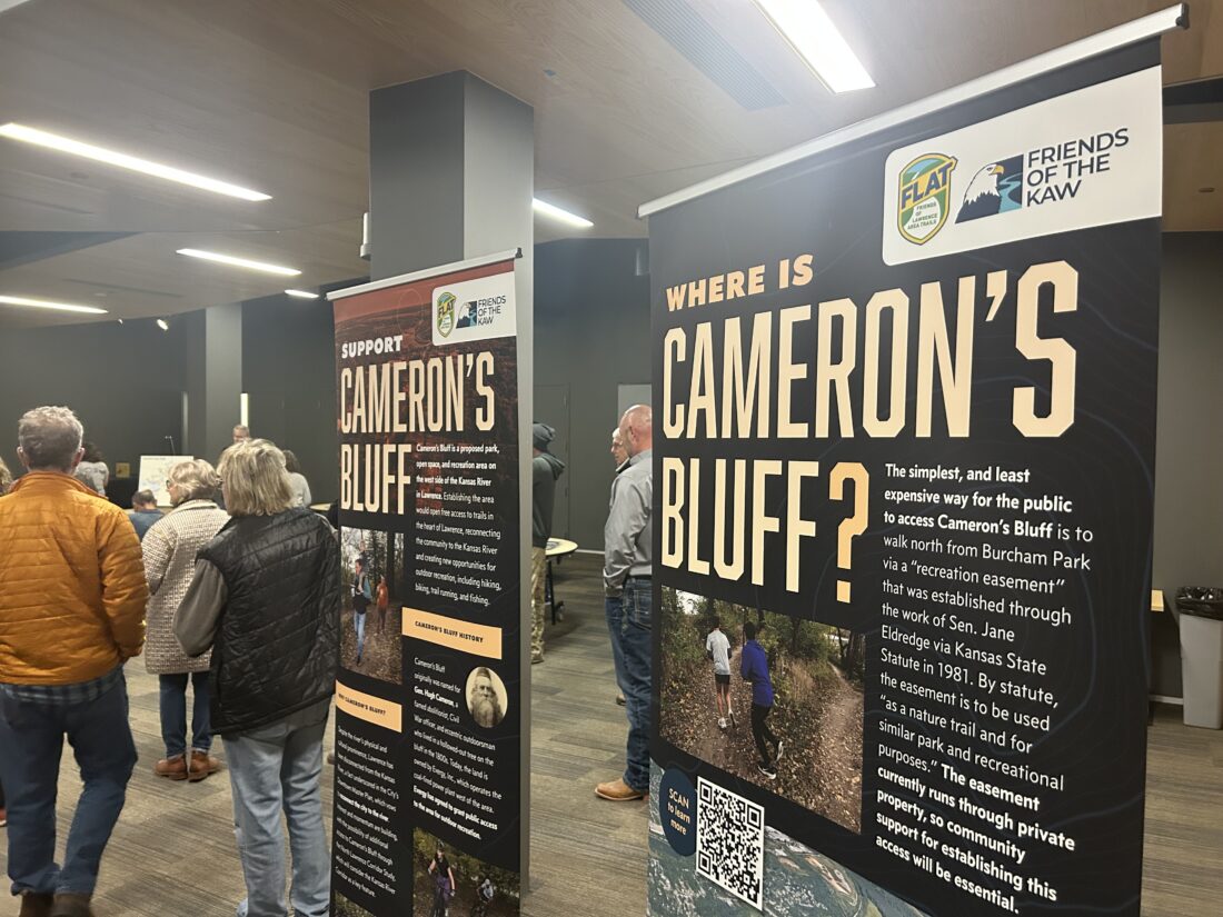
photo by: Bremen Keasey
Information posters created by organizers working to create a new park and trail system in an area north of Interstate 70 in Lawrence.
“We will need collaborative work to pull this off,” Hill-Nelson said, but she acknowledged it will be “a little bit of a challenge.”
Along with the presentation and areas for the public to share their suggestions on the future of the site and Lawrence’s trails in general, members of the public also asked questions about the project. The most pressing question was about the timeline of when they might see the project come together, but other people asked about the potential environmental impacts and also expressed concerns about how it could impact the surrounding private properties.
Another concern that was addressed was the fact Burcham Park — a potential site to connect Cameron’s Bluff — has been an area where many people experiencing homelessness have set up encampments. Some of that area had been cleared by the city in September, as the Journal-World reported, but a couple people asked about how the project would handle the fact there are some people still deeper in that area.
Hill-Nelson said that was another challenge, especially in part because the camps can be a “hazmat” area that can have lasting environmental damage from the use. She said the community is “going to have to figure out how to handle it,” and noted that the Lawrence Community Shelter has seen its services expand in recent years to support them. Hill-Nelson also said that if the area ends up being developed into trails, positive use of a space can often “displace the negative use” of the encampments.
The organizers also urged that the attendees of the event reach out to city and county commissioners to express their interest in the project — with Hill-Nelson saying she has not heard from one commissioner who hasn’t expressed support.
Chris Tilden, the chair of FLAT, said already the project has had a good deal of public-private partnerships to get to this stage. While there is still a lot to figure out to bring the park to fruition, this is an opportunity that could further grow Lawrence’s networks of trails.
“This trail would be an amazing addition to what is an amazing trail system in our community,” Tilden said.
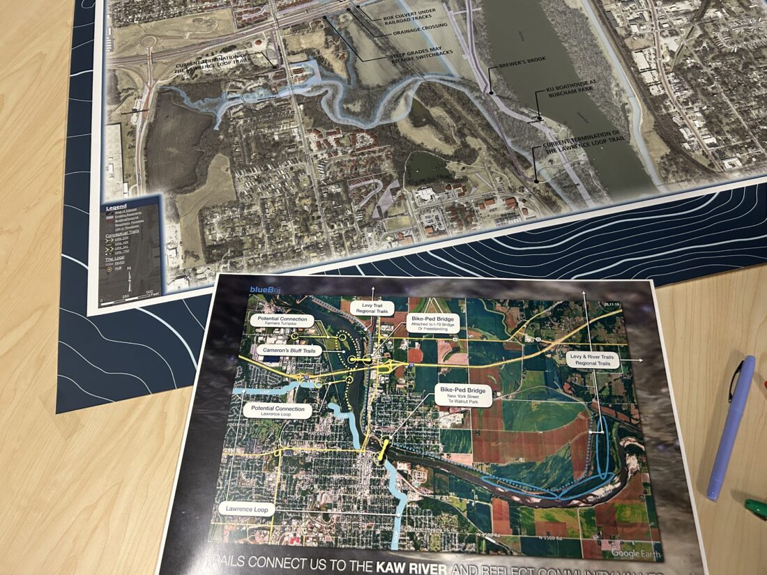
photo by: Bremen Keasey
Maps of Lawrence depicting the proposed park of Cameron’s Bluff, which would add around seven miles of trails north of Interstate 70.
Other News
Prairie Park’s artificial floating island is cleaning the water and hosting all kinds of wildlife

Farmland’s legacy: How what used to be the largest farmer-owned co-op left contaminated sites in Lawrence and beyond

New book to reflect on lessons from project that returned sacred boulder to Kaw Nation

Hundreds celebrate the unveiling of 20 new benches created by Van Go artists
Lone Star Lake on state’s watch advisory for blue-green algae blooms
The Kansas Department of Health and Environment on Friday added Lone Star Lake to its watch advisory for blue-green ...
