Lawrence City Commission to consider 143-acre annexation for SLT and Iowa Street development

photo by: Nick Krug
An area just southeast of the intersection of the South Lawrence Trafficway and Iowa Street is pictured in this 2017 file photo.
Lawrence city leaders will soon decide whether to expand the city’s boundaries in the area of the South Lawrence Trafficway to allow for a development that plans to add dozens of acres of new homes as well as additional commercial space to the city.
As part of its meeting Tuesday, the Lawrence City Commission will consider an annexation request for 143.41 acres located in the southeast corner of the South Lawrence Trafficway and Iowa Street (U.S. 59). The city’s professional planning staff is recommending the request for approval, but the Planning Commission voted to recommend its denial on a mixed vote.
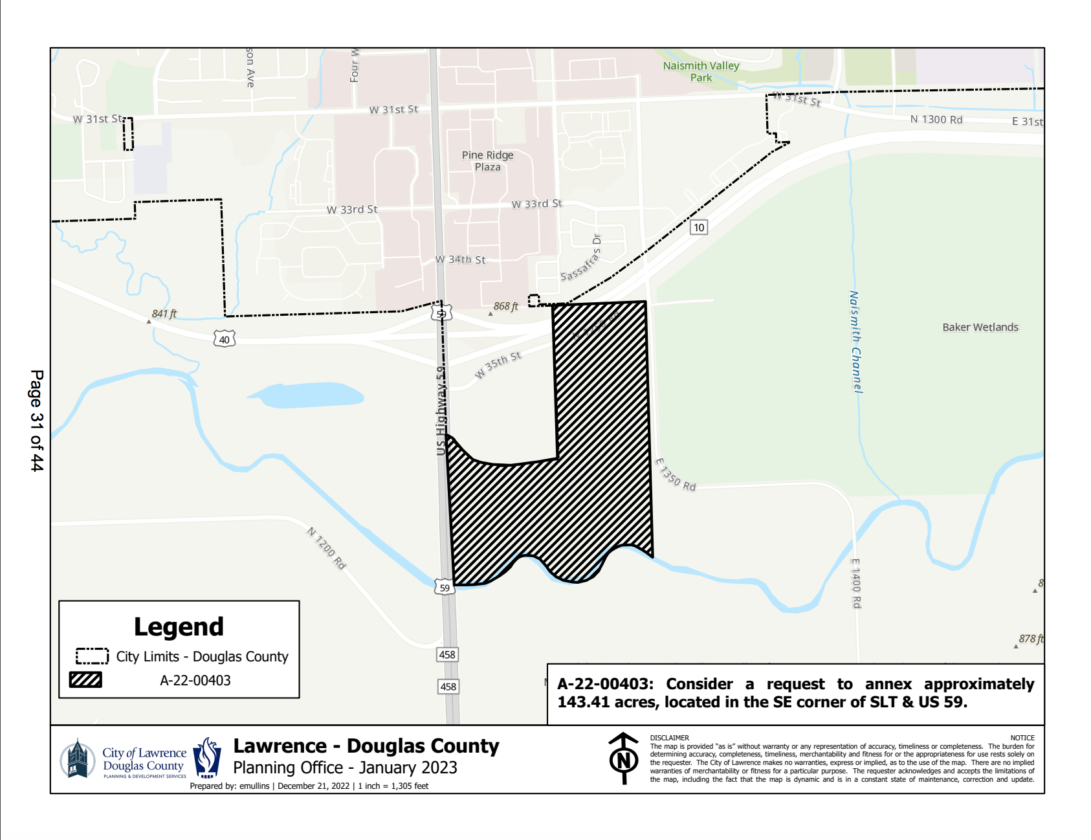
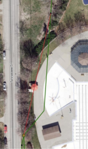
photo by: Lawrence-Douglas County Planning Office
A map shows a 143.41-acre annexation request located in the southeast corner of the South Lawrence Trafficway and U.S. 59.
The project, known as New Boston Crossing, calls for single-family homes, multi-family homes and commercial and open space, according to the annexation application. A group led by Wichita businessman Phil Bundy is pursuing the annexation. The project is next to 35 acres that have long been annexed but remain undeveloped, bringing the project’s total area to 178 acres. Some of the planned elements of the proposed project are as follows, according to a letter from the developer.
•46 acres of small residential lots to accommodate single-family homes, townhomes, and perhaps zero-lot-line homes, such as rowhouses, that extend to the edge of a property.
•18 acres of larger housing lots that would accommodate “mid-level” homes.
•26 acres of “commercial and service areas.”
•22 acres for public-purpose spaces such as parks and cultural amenities that would be appropriate for what developers said they hope will be a southern gateway into Lawrence.
•16 acres for an “entertainment district” that developers said would be easily accessible to all of Douglas County due to the major highways leading to the site.
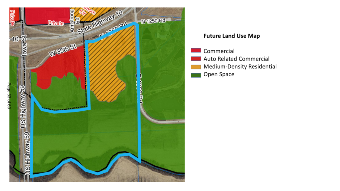
photo by: Lawrence-Douglas County Planning Office
A future land us map shows the planed uses for land located in the southeast corner of the South Lawrence Trafficway and Iowa Street (U.S. 59).
Planning staff recommends approval of the request, stating the annexation is consistent with the Lawrence-Douglas County comprehensive plan, Plan 2040, and the area plan for that location, known as the Revised Southern Development Plan. Planners’ recommendation also states that the annexation increases the inventory of residential lots in the city and facilitates residential development and protections of public open space.
However, the Planning Commission discussion brought up old concerns with developing the area, which has been turned down by city leaders on multiple occasions over the years. Following a lengthy discussion at its meeting Feb. 15, the Planning Commission voted 4-3 to recommend denial of the annexation.
Those against the annexation expressed concerns about the proximity of floodways for the nearby Wakarusa River to parts of the development and floodplain impacts on surrounding farmland. Those who voted to recommend the annexation emphasized the city’s need for more land, the inevitability of expanding past the SLT, the pressure the new Panasonic plant in De Soto will add to the area, as well as a belief that the policies and review processes the city has in place will address the issues of concern.
The annexation request is the first of several applications the development will need to submit as part of the process, including a rezoning, platting, site plan, public improvement plans, as well as a possible revision to the area plan, according to the memo. Platting of the property would occur through the major subdivision process and would include setting aside any required environmentally sensitive lands.
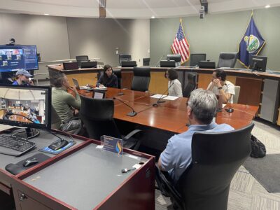
The Lawrence City Commission will convene at 5:45 p.m. Tuesday at City Hall, 6 E. Sixth St.
City Government
As Lawrence and partners update school routes, they’ve seen less walking and biking to most schools
Traffic will be affected near Watson Park as city installs a new stormwater tunnel
The Granada announces two more watch parties in downtown Lawrence for U.S., Algeria matches
Mowing at Prairie Park’s remnant prairie is part of a strategy to control noxious weeds; city, restoration team say it’s the least damaging option
Share your feedback on North Lawrence study at open house next month