Lawrence school district releases map of proposed new school boundaries should Broken Arrow, Pinckney close

photo by: USD 497
The recommended new boundary map to accommodate the closures of Broken Arrow and Pinckney schools.
Story updated at 6:27 p.m. Thursday, March 23:
The Lawrence school district has released a map of proposed new school boundaries should Broken Arrow and Pinckney elementaries close.
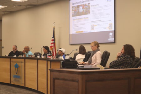
The Boundary Advisory Committee met on Wednesday evening, and consultants working with the district went over a proposal for boundary changes that was revised based on input from the committee at its last meeting. The committee voted unanimously in support of the proposal after directing consultants with RSP & Associates to make a change to one area to improve the efficiency of rural bus routes south of town. The map has now been released following those changes.
Components of the boundary changes, according to a summary from RSP, are as follows:
• Cordley expands south of 23rd Street to K-10 utilizing western boundaries of Naismith Trail and Louisiana Street (currently part of the Broken Arrow attendance area)
• Deerfield expands east along Sixth Street to the Kansas River (currently part of the Pinckney attendance area)
• Hillcrest expands north to Sixth Street and east to Massachusetts Street (currently part of the Pinckney and Cordley attendance areas)
• Langston Hughes expands southwest utilizing county roads and parcel lines (East 1135 Road, East 1100 Road, East 1150 Road) (currently part of the Broken Arrow attendance area)
• Prairie Park expands west to Highway 59 (Iowa Street) along K-10 (currently part of the Broken Arrow attendance area)
• Quail Run expands south of Bob Billings Parkway to the eastern portion of the Alvamar Golf Course (currently part of the Hillcrest attendance area)
• Schwegler expands southeast along 25th Street to Louisiana Street and south to K-10 (currently part of the Broken Arrow attendance area)
• Sunflower expands south to the district boundary utilizing west boundaries of county roads and parcel lines (East 1135 Road, East 1100 Road, East 1150 Road) (currently part of the Broken Arrow attendance area)
• Sunset Hill expands north to Trail Road (currently part of the Deerfield attendance area)
The public hearing for the potential closure of Broken Arrow will take place from 10 a.m. to noon on Saturday in the Broken Arrow school gymnasium. The public hearing for the potential closure of Pinckney will take place from 2 to 4 p.m. on Saturday in the Pinckney school gymnasium.
Individuals interested in participating in the public hearings may sign up in advance at PublicComment@usd497.org or complete a sign-up sheet at the hearings by 10 a.m. at Broken Arrow or by 2 p.m. at Pinckney. Public comments shared during the hearings may be related to either elementary school recommended for closure. On-site child care for school-age children will be provided.
The Lawrence school board will consider the potential school closures as well as the committee’s boundary recommendation at its meeting Monday, March 27. District spokesperson Julie Boyle said the board would receive and consider the boundary recommendation as part of Monday’s meeting, but would not yet vote on the boundaries.

photo by: USD 497
A Lawrence school district map shows the current elementary school boundaries.
K-12 Education

Concerns grow over Douglas County truancy proposal ahead of commissioners’ vote on new program
As Lawrence and partners update school routes, they’ve seen less walking and biking to most schools

Lawrence school district announces interim principals of New York Montessori and Quail Run Elementary School
Families and staff report positive experiences with Lawrence school district but want more academic challenge, community feedback shows
Lawrence school district maps out key goals for 2026-2027, including expanded preschool and college-credit access
