History repeated
Photos put focus on progress
The places look familiar, yet unfamiliar.
There’s Mount Oread, but without most of the buildings and trees.
There’s the Kansas River bridge, built with wood instead of concrete.
There’s Massachusetts Street, with cows roaming where cars now drive.
Alexander Gardner knew these places. John Charlton knows them, too.
Both men are photographers, separated by nearly 150 years of time. But now, because of a project recently completed by Charlton, their work forever will be linked.
Charlton, a Lawrence resident, has spent the last 12 years meticulously recreating the photos taken by Gardner in 1867. The photo collection offers a side-by-side comparison that shows the evolution of Kansas development and the impact of westward expansion on the land.
“The idea is to take the photos in exactly the same spot, in the same time of the year, at the right time of day so the shots match,” said Charlton, a photographer with the Kansas Geological Survey. “You can probably read them in different ways. I’m trying to do this in the most objective and straight-forward manner.
“It’s a story. I think it’s a fascinating story.”
Railroad photographer
The story began in 1867, when Gardner, a former Civil War photographer for the famed Matthew Brady, crossed Kansas as the official photographer of the Union Pacific Railroad.
His subjects included many shots in Lawrence, including downtown, Mount Oread, the Kansas River and several landscape photos from the tops of hills.
Other towns included in the collection are Kansas City, Tonganoxie, Lecompton, Topeka, Hays, Junction City, Emporia, Hays and Ellsworth.
“I think he was amazed by this different landscape,” Charlton said. “He was creating a new photographic sense of the landscape.”
Gardner took many of the photos with a stereographic camera, which took twin photographs that could be put into a hand-held device called a stereoscope. The process provided a three-dimensional view.
Today, the stereographs can be viewed with 3D glasses.
Long process
Charlton, a fifth-generation Douglas County resident, decided in the early 1990s to recreate Gardner’s pictures, to give a look at how the sites photographed in 1867 had changed over time. Charlton took his first set of photos in 1993.
The work was sometimes painstaking, using old maps, local residents and clues in the photos to pinpoint the exact locations where Gardner took 150 of his images. Charlton examined shadows in the original photos to approximate the time of day the photos were taken.
Sometimes, when he wasn’t satisfied with the angle or lighting, he’d drive back to locations to retake the photos.
He also replicated the style of photography, using a 1950s-era stereographic camera.
“It helps you see how the state developed, how we got to where we are and who did it,” Charlton said.
The photos are now available on the Kansas Geological Society Web site, www.kgs.ku.edu. Charlton said he someday would like to have the sets published in a book, but he’s had a difficult time finding a publisher.
Branching out
One of the most dramatic differences in the photos is the number of trees.
In 1867, there were few in Lawrence. Now, Charlton said, he had a hard time getting good perspectives to match Gardner’s image because there were so many trees in the way.
“With Mount Oread, what’s striking with that is it’s essentially a prairie hill,” said Kelly Kindscher, an associate scientist at the Kansas Biological Survey.
Settlers got to work early planting trees, to make the town look more like their native New England. And the settlers’ presence meant there were fewer wildfires to ruin the trees that were there, Kindscher said.
Meanwhile, there are areas near the Kansas River with fewer trees, where residents cut them down for firewood or to build houses.
The photos from farther west of Lawrence show how much pristine prairie has been lost over time.
“There’s so little native prairie left,” he said. “I’d say 98 or 99 percent of the landscape has been significantly altered.”
‘Cultural perspective’
The presence of man-made structures in Lawrence has changed much over the years, too.
Photos from 1867 show a sparsely populated village, with plenty of green space between many houses. The newer versions indicate urban sprawl and denser development.
But some of the landmarks haven’t changed much over time.
“It’s remarkable how the path is set early,” said Karl Gridley, a Lawrence historian. “There are consequences of what we did back then. The bridge over the river is in the same spot it is now.”
Likewise, the photos downtown – aside from the dirt road and cattle roaming Massachusetts Street – show things haven’t changed much. Much of downtown had been rebuilt after Quantrill’s raiders burned buildings four years earlier.
“I always say when you walk through Disney World, they have a Main Street USA. It’s meant to represent a period of time that’s gone,” said Steve Jansen, another local historian. “You can walk down the 700 block, 800 block or part of the 900 block (of Massachusetts) and you have a sense of Main Street USA.
“If the photographs help us to better appreciate how precious and lucky we are, that’s great. John not only gives us a better visual perspective, but a better cultural perspective.”
Arts and Entertainment
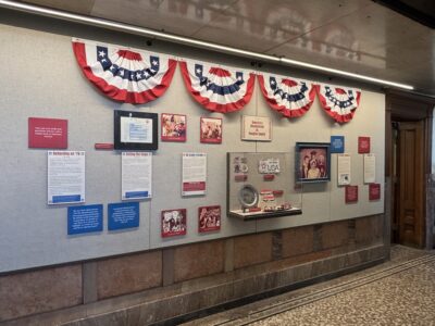
Watkins Museum to open special exhibit detailing how Douglas County celebrated America’s Bicentennial

Go, See, Do: Kaw River Roots Festival, markets and more

Soccer gear honoring Lawrence history’s all-star team is now on sale as part of city’s public art exhibition

Nominations, call for artists open for Lawrence’s 2026 Phoenix Awards
Go, See, Do: ‘Addams Family’, PRIDE parade and a host of library events among offerings