Looking growth in the eye
Lawrence at crossroads over expansion
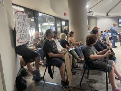
Lawrence can’t afford to live in fear anymore.
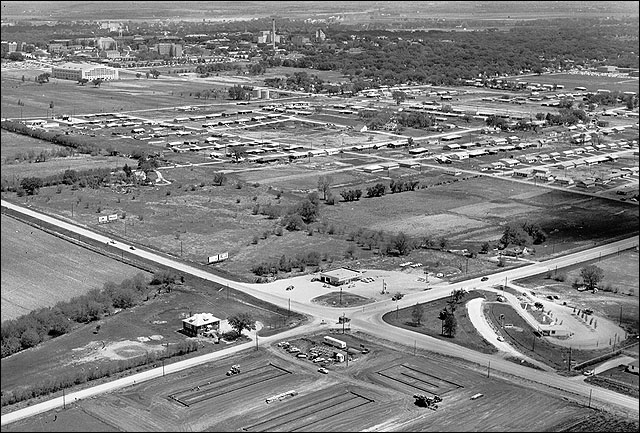
Believe it or not, this is what the intersection of 23rd and Iowa streets looked like in 1955, looking northeast toward Kansas University and downtown Lawrence. The Kansas River is at the top. The old No. 6 School, lower left, is still standing. Just below the intersection, construction was under way for Lawrence's first Holiday Inn. The Big Buy Drive-In, home of Kansas' first Kentucky Fried Chicken franchise, is at the lower right of the photo.
Les Hannon, a retired strategic planner and Lawrence resident since 1973, is convinced that fear that Lawrence will lose its character is the primary problem the community faces as it struggles with how it should grow.
“We are caught in a heck of a dilemma here,” Hannon said. “We don’t want to grow because we love what we have. But people want to live here because they love what we have, too, so we’re bound to grow.”
Hannon said the solution is simple, albeit a bit hair-raising: Think big. Stand up and look growth in the eye, and recognize that we can’t stop it, but we won’t let it swallow what we love either.
“We absolutely should stop living in fear that we’re going to lose our downtown, that we’re going to lose our character,” Hannon said. “We have friends who have that type of fear, but I think people are beginning to realize that we can grow and still protect what we have if we do it properly.”
Hannon – a former partner with the strategic planning firm The Leawood Group, which created the long-range plan for the 1,800-acre Argonne National Laboratories outside Chicago – is taking his message to the streets. Hannon has spent weeks privately pitching to city leaders an ambitious big-picture plan that shows how Lawrence could grow to 140,000 people by 2030 and still have massive amounts of greenspace, open up vast areas of land for development south of the Wakarusa River and protect the city’s downtown.
“I’m becoming the strategic long-range banner waver,” Hannon said.
Several leaders are glad someone has taken the flag.
City Commissioner David Schauner, who has seen Hannon’s proposal, said it might end up being a good primer for an even larger discussion the city needs to have. Schauner and City Commissioner Sue Hack have been saying for the last several months that the community needs to go through a “visioning” process that would involve bringing in an outside consultant.
“As a community, we are uncertain about where we are going,” Schauner said. “Since we don’t have a road map, we are very tentative about what we do. If we had a better sense of destination, I think we could move with more certainty on a lot of these planning issues.
“I’m afraid that as a community, we don’t really know what we want to be when we grow up. We need to answer that question.”
Mapping possibilities
Hannon paints a pretty picture of what Lawrence could become. And he uses a lot of green. At the centerpiece of his plan is a massive greenbelt that would run along both sides of the Wakarusa River from Clinton Lake on the west to at least the Baker Wetlands on the east.
“Dedicate it so it could become a Central Park for Lawrence,” Hannon said referring to the famed New York City park. “Dedicate it for posterity. It would be there forever, and we would never allow commercial, industrial or residential development in the green belt.”
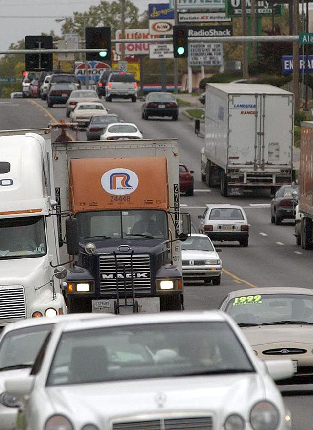
A far cry from the barren thoroughfare of 1955, 23rd Street now serves as a major traffic artery in Lawrence and often is congested with travelers heading east and west.
But planners would need to allow roads to run through the greenbelt. Hannon said the community couldn’t afford to allow a greenbelt to become an artificial boundary that development can’t cross, which he said had happened in some greenbelt communities such as Boulder, Colo.
Hannon said the area south of the Wakarusa River likely would become the city’s most attractive area for development, in part because fast-growing western Lawrence was becoming farther from the center of the community and parts of the area were outside the boundaries of the Lawrence school district.
So Hannon said the city needed to begin planning now for major road expansions to get people into and out of the new South Lawrence.
Hannon said the city needed to be prepared to widen or extend Wakarusa Drive, Kasold Drive, Louisiana Street and Haskell Avenue to four lanes and extend each of them south of the Wakarusa River and connect to a new street that he’s dubbed 47th Street. The new four-lane 47th Street – built somewhere around the existing North 1100 Road – would connect Kasold Drive and Haskell Avenue south of the Wakarusa River and would become South Lawrence’s major east-west route.
Hannon said the four road expansions and the new 47th Street needed to be in place as early as 2012 and no later than 2020.
And, of course, there’s one other road that factors into any discussion of southern Lawrence – the South Lawrence Trafficway. Hannon said that it must be completed, and the eastern leg should be built as four lanes and the already completed western leg should be expanded to four lanes. But he said as a planner he didn’t think it made much difference whether the road was completed through the Baker Wetlands as proposed or south of the Wakarusa River.
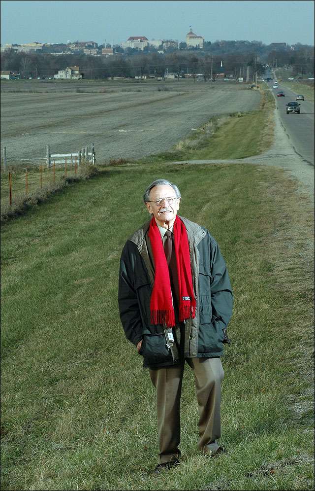
Les Hannon, a retired project engineer who played a major role in the planning of Argonne National Laboratories in suburban Chicago, has been shopping around a plan to leaders in Lawrence to prepare the city for a population of 140,000 by 2030. One vision Hannon has is for the city to create a large green space, Lawrence's central
Hannon said good long-range planners couldn’t allow themselves to get caught up in political battles.
“I try very hard to look at this as an engineer and a planner, which means nonpolitically,” Hannon said. “I think that is the absolute key to all of this.”
New directions
Hannon doesn’t spend all his time gazing south. He said the city had plenty of work to do to the north as well. He said the city needs to be prepared for the Farmers Turnpike, also known as County Route 438, northwest of Lawrence to be a major four-lane city street by 2020. It should be a four-lane road all the way to Trailriders Road, also known as East 800 Road, west of Lawrence. Hannon said Trailriders would become the next version of Wakarusa Drive for the new West Lawrence.
Peterson Road, which ends in a rural neighborhood, needs to be extended west – preferably without going through property donated for future parkland – to connect to the South Lawrence Trafficway.
And there’s more than just roads Lawrence needs to plan for. Making sure the city thinks big enough with plans for a new wastewater plant along the Wakarusa River, scheduled for completion in 2011, is critical, he said. Hannon said the city needed to buy enough land now to expand the plant several times to allow it to meet the city’s needs for the next 60 years.
The community also needs to engage in serious discussion with the school district to determine when a third high school may be needed and in what direction it most likely would be located.
And then there are broader issues related to the demographics of the city’s population. Hannon said it was likely that retirees would become a larger percentage of the city’s population.
“The retirement business is probably going to become big business in Lawrence,” Hannon said. “Our health-care sector probably will have to grow much heavier than it has in the past.”
Reactions
Hannon’s effort is being applauded by some. Phil Struble, president of Landplan Engineering, has heard Hannon’s presentation and said he was most impressed with the general message.
“It is finally nice to see someone who is not in my business who says we need to think bigger,” said Struble, whose company does design and planning work for developers across the city. “We have been saying that for a longtime, but I think it is great that a member of the public who has zero vested interest is saying it.”
Mayor Boog Highberger said he appreciated Hannon’s work, but didn’t want people to get the idea city planners haven’t been able to think big.
“I think we are already doing a lot of the things that he’s recommending,” said Highberger, though many of the road projects Hannon proposes for south of the Wakarusa River are not in the current version of Transportation 2025, which is designed to list major road improvements the community will need in the next two decades.
But Highberger said city planners were updating that document, and he said the city had undertaken many efforts to plan for a much larger city. For example, the city’s wastewater plans are based on a population of 150,000 people by 2025, or about 20,000 people more than Hannon has based his projections on.
City Government

Soccer gear honoring Lawrence history’s all-star team is now on sale as part of city’s public art exhibition

To honor public servants, Lawrence’s July 4 celebration will have a whole gallery of their photos on display; submissions open now

North Lawrence study consultants look at possibilities for a grocery store, food truck park, traffic calming and more

Algerian ambassador gives Lawrence a gift for supporting national team – a piece of art
Lawrence City Commission approves incentives for Alarm.com’s office project in downtown building