Public weighs in as Douglas County begins refining long-term plan for Wakarusa River Corridor
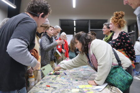
photo by: Josie Heimsoth/Journal-World
Community members gather at an open house on Thursday, Nov. 20, 2025 for the Wakarusa River Valley Vision & Area Plan.
Community members packed an open house to give feedback on a long-term vision for the Wakarusa River Corridor, voicing concerns about development and suggesting ideas for access, conservation and honoring Indigenous history.
On Thursday, Douglas County staff hosted an open house for community members to provide more input on what the future of the Wakarusa River Corridor should look like. For several months, the county’s sustainability team and planning firms, Biohabitats and Hoxie Collective LLC, have been working on The Wakarusa Corridor Vision & Area Plan. It’s a long-term planning project to guide future development and conservation in the Wakarusa River corridor, balancing growth with environmental protection.
The project involves two phases of community engagement. The first phase took place between March and August, and it was about getting an early sense of who cares about the river, why it matters to them, what they hope for its future, and what they value most. The team is currently in the project’s second phase — bringing those ideas back to the community, sharing what the group learned and asking for feedback.
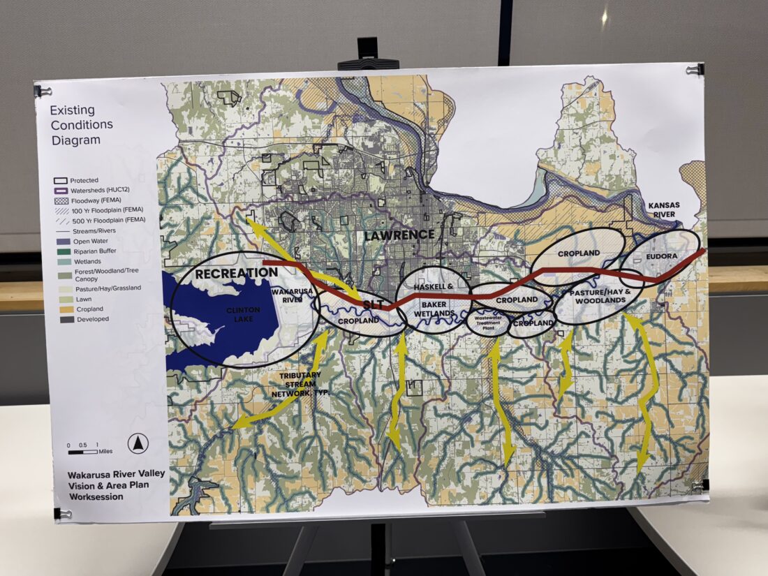
photo by: Josie Heimsoth/Journal-World
An overview of the existing conditions along the Wakarusa River.
“At this phase, we are really in the stage of, here’s what we’ve heard and here’s what we think is possible,” Kim Criner Ritchie, sustainability manager for Douglas County, said.
Community members were asked to engage with several boards around the room by placing Post-it notes with responses to questions like how they would like to see access to the river valley and what they envision the future of the area to be.
One Post-it – and others like it – said “limiting and banning development needs to come first,” while others highlighted specific concerns about the New Boston Crossing project, a planned mixed-use development on approximately 177 acres southeast of the Kansas Highway 10 interchange at Iowa Street.
“Boston Crossing, if developed, will result in development that does not preserve integrity of the Wakarusa Valley watershed,” a note said.
Another said it would be important to “avoid zoning changes that risk loss of open space.”
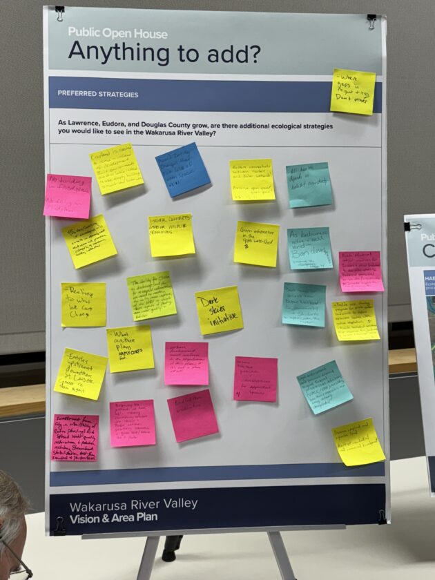
photo by: Josie Heimsoth/Journal-World
Community members shared additional ecological strategies they would like to see in the Wakarusa River Valley on Thursday, Nov. 20, 2025.
Last month, planning commissioners approved a request to change the city and county’s comprehensive plan, Plan 2040, to include more area for commercial and high-density residential uses at the proposed New Boston Crossing site. Currently, the request is anticipated to be considered by Douglas County commissioners at their business meeting on Dec. 10, according to a memo to commissioners from Wednesday’s meeting. It has yet to go before the City of Lawrence.
Some notes said there should be investments in land or wildlife crossings. One of the notes suggested the idea of an underpass underneath the South Lawrence Trafficway, which could be used for wildlife to better access the Baker Wetlands and its ecological resources.
When it comes to accessing the Wakarusa River recreationally, many wanted these opportunities to be expanded. One person wrote that they would like “the potential of more trails, more river access (and) more people forming relationships with the river.” Another note wanted to see work in expanding open green spaces and having more public spaces and potentially partnering with landowners.
Access and recreation of the river
There were three different scenarios the developers of the Vision & Area Plan put together to help see how the community would like to see access and recreation of the Wakarusa River.
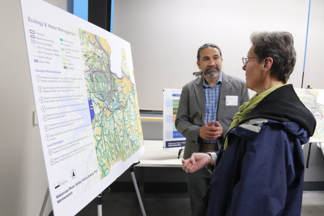
photo by: Josie Heimsoth/Journal-World
Aiman Duckworth with Biohabitats shares some potential ecology and water management strategies for the Wakarusa River Corridor on Thursday, Nov. 20, 2025.
The first scenario had the idea to “use what we have and leverage existing opportunities.” Examples of this include access and connections to the river from the Lawrence Loop system and with public property; park and river access at Clinton Lake and/or the Baker Wetlands; access and connections near Eudora within Bluejacket Park; and more.
The second scenario wants to “use what we have and imagine new opportunities,” including the potential for new trails to public buffer lands on the north side of the river as well as possible river access at East 1600 Road. The scenario also wants to explore limited recreational use of wastewater treatment plant lands given the vast riverfront at those properties and expand access to a future park priority site in Eudora.
The final scenario wanted to “imagine new opportunities from Clinton Lake to the Kaw” with new trails and recreational opportunities via acquisitions, easements and as development allows, new biking bridges in multiple locations and more.
A note on Haskell Indian Nation University priorities
Another priority people called attention to was restoring connectivity between Haskell Indian Nations University and the Baker Wetlands. There was also a note that wanted there to be an effort to better communicate the Indigenous history of the Wakarusa River Valley with the public – whether through signage or hosting public talks at the University of Kansas, the library and at Haskell.
The developers of the Vision & Area Plan mentioned in a handout at the open house some of the history of the university. Haskell was originally known as the United States Industrial Training School, opening its doors in 1884. The school was designed to assimilate Native students, and it focused on Western agricultural education, for students in first through fifth grade.
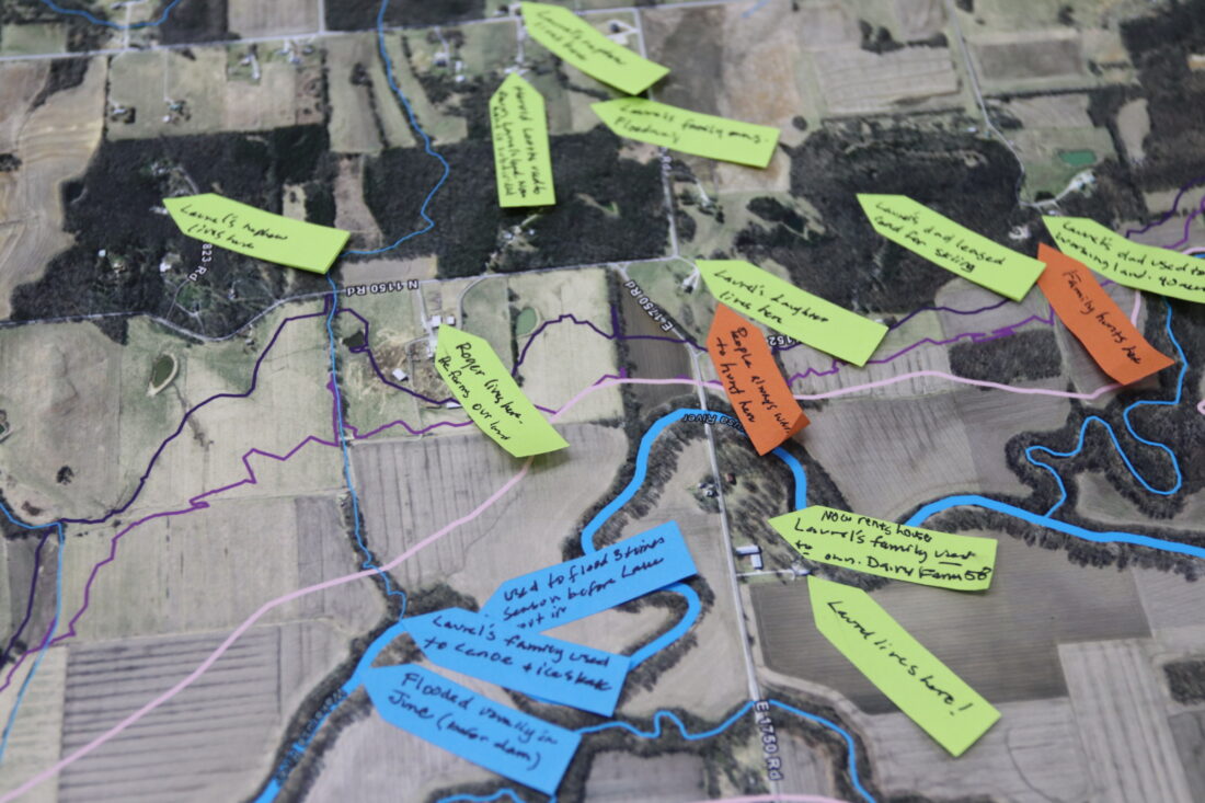
photo by: Josie Heimsoth/Journal-World
Community members were invited to add their own meaningful places and stories along the Wakarusa River on a map at the open house on Thursday, Nov. 20, 2025.
By 1922, there were three large ditches that drained the Haskell wetlands and students were compelled to tend crops. The farming program ended in 1934, after a report documented abusive conditions including poor diet, overcrowding, below-standard medical care and an emphasis on physical labor rather than providing an education.
Before Haskell was reorganized, students would try to escape and would try to find their way home through the wetlands, the handout said according to records and elders. “Today, there are serious concerns that the wetlands became the final resting place for some,” the handout said.
Although archaeological data cannot be freely shared, records maintained by the State Historic Preservation Office indicate that the Wakarusa corridor warrants archaeological investigation before any development proceeds, the handout said. Several locations hold particular historical significance for the Haskell community, as they were used for decades as storage and disposal areas for Haskell materials prior to the wetlands being transferred and sold.
“In light of this history, our planning process includes a specific effort to incorporate strategies deemed valuable by (Haskell),” the handout said. “A private upcoming workshop will review and finalize candidate recommendations for the Vision & Area Plan.”
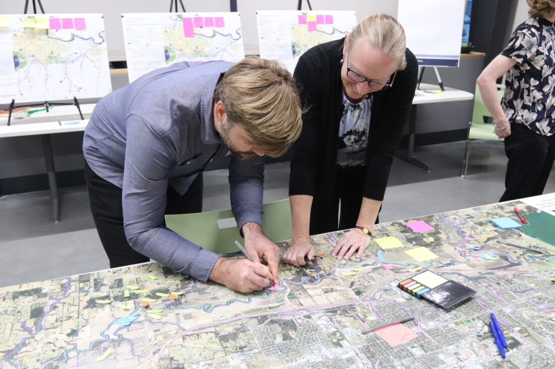
photo by: Josie Heimsoth/Journal-World
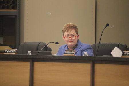
County Commissioner Karen Willey attends an open house for the Wakarusa River Valley Vision & Area Plan on Thursday, Nov. 20, 2025.
Next steps
Criner Richie said the Hoxie Collective LLC will be collecting the feedback from Thursday’s open house and compiling a summary report that will be posted online and shared with the public.
Criner Richie said one of the most satisfying parts of the project is seeing just how many organizations and staff are working toward some of the same values and goals of open space for future generations.
“Knowing that we all kind of share a goal and that we’re all really excited to work together toward that, that’s been really great,” Criner Richie said.
The final phase of the project is expected to begin in December, where the team will begin developing the Corridor Vision Plan. The final draft and document is anticipated to be complete in March 2026 and presented to commissioners.
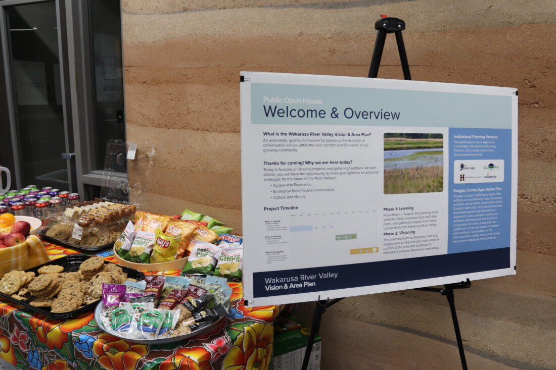
photo by: Josie Heimsoth/Journal-World
An open house for the Wakarusa River Valley Vision & Area Plan was held on Thursday, Nov. 20, 2025.
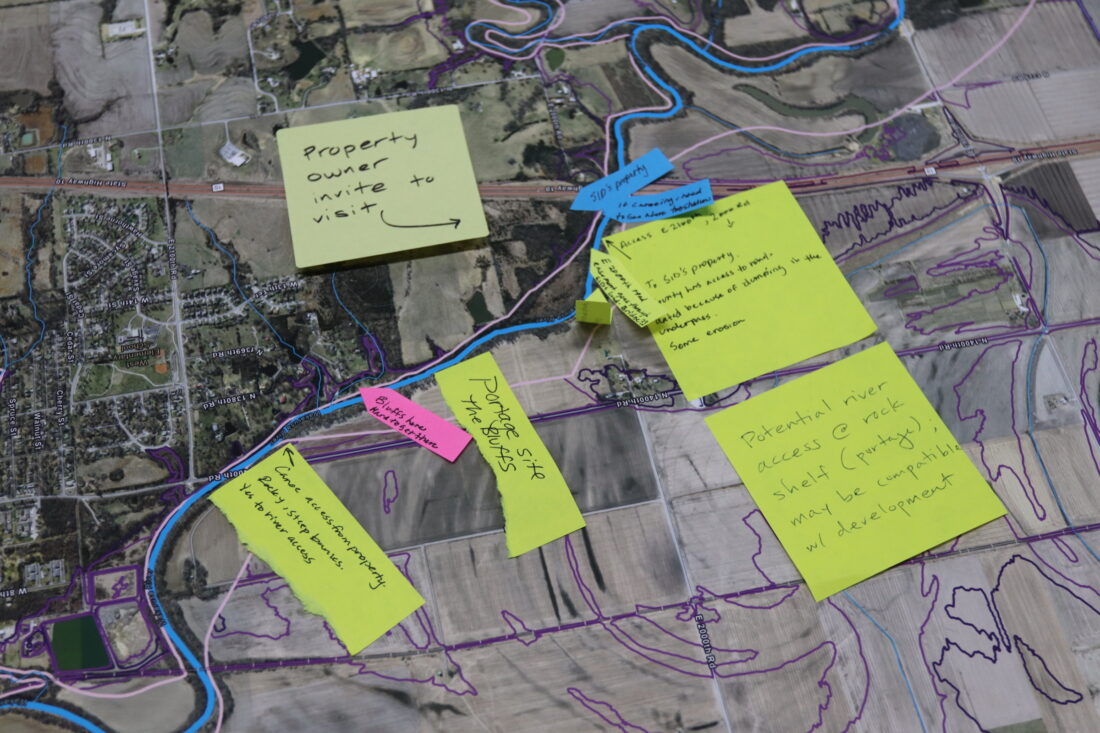
photo by: Josie Heimsoth/Journal-World
Community members were invited to add their own meaningful places and stories along the Wakarusa River on a map at the open house on Thursday, Nov. 20, 2025.
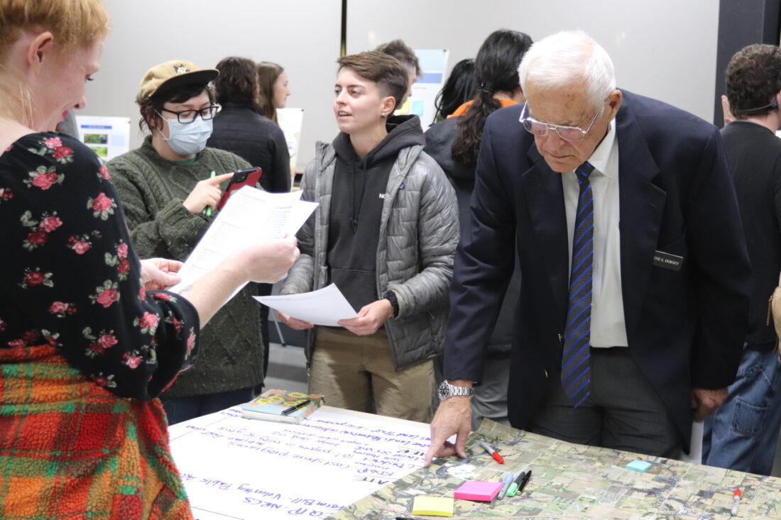
photo by: Josie Heimsoth/Journal-World
County Commissioner Gene Dorsey attends an open house for the Wakarusa River Valley Vision & Area Plan on Thursday, Nov. 20, 2025.
Other News
One incumbent and one newcomer have so far filed for a seat on the Douglas County Commission
Douglas County commissioners to decide addiction and alcohol fund allocations, consider application process changes
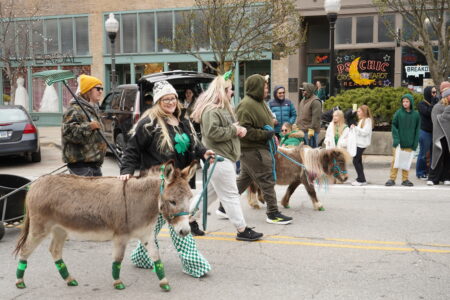
PHOTOS: Lawrence St. Patrick’s Day Parade of 2026
Superintendent says Lawrence school district will continue ‘streamlining,’ doesn’t say which positions will be affected or how many
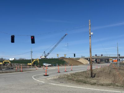
Part of U.S. 59/Iowa Street to close for bridge work related to South Lawrence Trafficway expansion