Lawrence commissioners to consider redesign of part of Mass Street to add protected bike lanes, reduce lanes for cars

photo by: Bremen Keasey/Journal-World
A bike route sign on Massachusetts Street is pictured near the intersection of 21st Street.
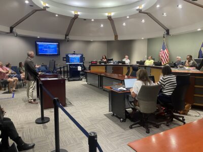
City commissioners will consider approving a redesign of a portion of Mass Street that shrinks space for cars from four to three lanes and adds protected bike lanes as part of a multimodal redesign.
The potential addition of bike lanes to Massachusetts Street from 14th Street to 23rd Street had been explored by the city since 2023, as the Journal-World reported. That corridor is part of the priority bikeway network for the Lawrence Bicycle Plan, the city’s guide for crafting a safer and more comfortable bike network. After a presentation during an April 9 meeting, the commission asked city staff to return with more information on design options, operations and maintenance and comparable projects in other municipalities.
Now, the city is recommending adding a design option to the commission that would add five foot bike lanes to the outer portion of the road, build in a three foot median between the bike lanes and car traffic and convert the lanes from cars from four to three lanes. There would be one lane for cars going northbound, one lane going southbound and a turning lane in the middle.
According to a staff presentation, the city believes that road re-design would be the safest option and the best option for solid waste pickup along that stretch of road. According to data from the Lawrence – Douglas County Metropolitan Planning Organization, 65% of fatal and serious injury crashes in Lawrence occurred on just 6.5% of the roadways. That stretch of Massachusetts Street is one of those corridors where a higher rate of serious crashes occur, and the report found it poses a higher risk to pedestrians and bike users because there are more pedestrians or bikers in that area.
The city estimates there would be increased cost to operations and maintenance of that stretch for street sweeping or clearing snow that would amount to a 230% increase from the current rate, in part because of the need to clear the protected bike lanes.
The commission will also consider approving a $494,915 design agreement with Trekk Design Group as part of the agenda item to create the final design. The city estimates the construction of the project would be about $5.6 million. Already, the city has secured $3.37 million from two different grants from the Kansas Department of Transportation for the project, while another grant application to the BlueCross/BlueShield Pathways is still pending.
The project is similar to another future “road diet” concept the commission approved that would add bike lanes along another key corridor in Lawrence. The commission voted 4-1 in October on a plan to redesign Ninth Street from Illinois Street to Vermont Street that would decrease the lanes of car traffic from four to three lanes along that section while adding in protected bike lanes, as the Journal-World reported.
In other business, commissioners will consider approving a plan to install educational panels about Indigenous history in the area at Robinson Park.
The tiny park in downtown Lawrence previously featured, Iⁿ’zhúje’waxóbe, a 28-ton red quartzite boulder that was taken from the Kaw’s traditional homelands nearly a century ago and made into a monument to Lawrence’s white settlers in the park. Last year, the Sacred Red Rock Project group led the effort to remove the rock from the park and return it to the Kaw, and it was installed in late March of this year at the Kaw’s Allegawaho Heritage Memorial Park just outside of Council Grove.
The Sacred Red Rock Project group’s request to install two educational panels — one describing the history of a boulder sacred to the Kaw Nation, the other a general overview of Indigenous history in Lawrence — at the park was approved by both the Historic Resources Commission and the Parks and Recreation Advisory Board.
The proposed panels feature imagery meant to bust stereotypes that people may have about Indigenous culture and history. Additionally, the panels will have references to Watkins Museum as a way to highlight the broader history as well.
The group has been looking into other ways to reshape the park. In September, as the Journal-World reported, the group heard from the public about a proposal that would rename the park to honor the Indigenous community and brainstormed ideas for a monument to fill the void left by the removal of the boulder.
City Government
With city leaders’ approval, Lawrence Public Library’s outdoor pavilion should soon be under construction
Sustainability board wants the environment to be ‘an underpinning’ of Lawrence’s next strategic plan

AG Kobach warns Lawrence, 2 other Kansas cities to repeal their bans on conversion therapy within 60 days
Polian thinks Lawrence City Commission can still find consensus on forensic audit of capital projects
Potential ballot question on directly elected mayor needs much more discussion, Lawrence city commissioners say