Mapmakers savor every detail in making Kansas more accessible

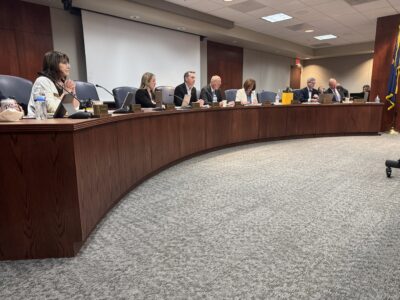
NAVTEQ employees Julie Barr and Sarah Flaskerud cruise southeast Lawrence recently to collect and code geographical data. The information is used for Global Positioning System devices and online services such as Mapquest and Google Maps. The two women, who are responsible for mapping all of Kansas and western Missouri, may drive 20,000 to 30,000 miles a year. Below is a detail of the computer in their SUV that logs details of their trip, including distances, curves in the roads and street signs.

That white Ford Escape with an antenna on top slowly prowling your neighborhood is probably nothing to be worried about.
In fact, it just might be putting your little neighborhood on the map.
Literally.
The SUV is driven by Julie Barr and Sarah Flaskerud, two employees of NAVTEQ, a company that collects and codes all the data that go into your GPS devices and online at Mapquest and Google Maps. Barr and Flaskerud are the road team responsible for mapping all of Kansas and the western part of Missouri. They may drive 20,000 to 30,000 miles in a given year.
“We’ll get the names of the streets, the addresses and everything,” Flaskerud said. “Everything” includes things like speed limits, roundabouts and medians.
As the pair drives into a new subdivision south of the intersection of O’Connell Road and 23rd Street, Barr starts calling out street names and addresses. Flaskerud uses a pen tablet to record all the data into an onboard computer. All the while, the built-in GPS tracker is logging every spin of the tire and bend in the road.
It’s in this neighborhood that Oren and Patricia Purdon plan their excursions in their RV. If they tried to input their address to most online map tools, the location shows up in the middle of what looks like a vacant field.
Audra Jackson has the same problem.
“When we first moved out here, there was nobody around,” Jackson said.
In fact, when she moved into her house, the mapping tools didn’t even recognize her address as valid, she said.
Soon, not only will the address be valid, the roads in her neighborhood will show up on a variety of navigational aids.
Once the field crews have driven the roads, the data is uploaded into a database, which is then offered for sale on a quarterly basis to companies such as Google, Yahoo, Garmin and Mapquest. NAVTEQ employs more than 500 people whose job is to just drive.
“Every day, somebody, somewhere, is putting something new into the database,” Flaskerud said.
As Barr drives down the road, a camera is recording images of street signs and minute details that the pair might miss.
“Every time we go out, we go out for an entire day,” Flaskerud said. “We always work in pairs. You can’t be looking at the screen and driving.”
Lawrence seems to be a relatively easy spot for the NAVTEQ crews to map. Barr said she knows of several crews who have been stopped by local police when residents reported suspicious activities. Barr and Flaskerud said they’d never been a part of something so dramatic, but they have been questioned by local residents who wonder what they’re doing.
Nothing so exciting happened the Thursday afternoon. Though the crews don’t go out when the weather is bad, some snow remained on the ground, making the job a little more difficult than usual. The pair spent extra time finding signs through blowing snow.
Adding new roads to the map is one aspect of the job. The other is adding extra details to the existing national road database.
In Kansas, six counties have been driven from end to end, road to road: Douglas, Leavenworth, Shawnee, Johnson, Wyandotte and Sedgwick. Maps of these counties include extra attributes such as roads, medians and other road features that may not show up on a generic map. Even new restaurants wind up in the database, Barr said.
NAVTEQ has set a goal of 2008 for getting every county in the country up to that level.
State Government

‘If it ain’t broke, don’t fix it’: Retired Judge Sally Pokorny tells residents why she opposes electing Supreme Court justices
KU professors would be limited in how they could present the idea of systemic racism in future classes
State legislators push back against federal energy regulators ending competitive bids
TOPEKA — Two Kansas legislators asked federal energy regulators to ensure competitive bidding occurs on ...
Senate confirms 1st of 3 Kansas nominees to U.S. District Court
Corporate income tax collections falling sharply in Kansas; Republican, Democratic leaders disagree on what it means
TOPEKA — Corporate income tax collections in Kansas have almost halved since last year, while other sources trend ...
Candidate’s campaign manager created website with documents used to attack rival
TOPEKA — Kansas U.S. Senate candidate Patrick Schmidt’s campaign manager left his digital footprint on ...