Thanksgiving travelers may experience potential snow and flight impacts this weekend
Lawrence may get some snow on Saturday

photo by: Kim Callahan/Journal-World
A snowy Massachusetts Street is pictured Tuesday morning, Feb. 18, 2025.
A chilly Thanksgiving will kick off a colder-than-normal end to November, with forecasters saying that Saturday’s rain could flip to snow, especially to the north and east.
On Thanksgiving Day, the high will be around 44 degrees Fahrenheit with a forecast of mostly sunny and a low of 24 degrees. Friday — which includes a KU home football game at 11 a.m. — will likely have late rain with a high near 43 and a low around 37 degrees. And on Saturday, rain will be likely before noon and possibly mixed with snow before midnight with a high near 45 degrees and a low around 20 degrees.
The National Weather Service said there may be potential for snow on Saturday, and the highest chances for impacts from snow are northeast from Iowa into Illinois. However, rain changing into snow could still impact northeast Kansas. According to a social media post, temperatures will likely be warm enough for rain initially before cold air moves in, supporting wintry precipitation at some point on Saturday.
“There is a low pressure system that moved through mostly to the north of us, like through the upper Midwest (Tuesday) night,” Chelsea Picha with NWS said. “So that brought a colder air mass along with it, and that pattern looks to just kind of stick around with us into early next week.”
Picha said depending on how fast the colder air comes in, the area could see some of the rain transitioning into snow on Saturday afternoon and into the evening.
“At this time, we’re not looking at a lot of travel impacts, maybe a dusting of snow,” Picha said. “Looks like the bigger snow impacts would be to the north and east of the area … but we’ll still be keeping an eye on that for sure, knowing that there will be people traveling after Thanksgiving.”
In addition, below-normal temperatures are anticipated to end November and continue into early December, from Nov. 29 to Dec. 3, the NWS said. According to a social media post, the normal high for the area during this time of year is in the upper 40s and the normal low is in the upper 20s, but temperatures are expected to be colder.
“Highs in the 40s and lows in the 20s – that’s more typical for January and December,” Picha said. ” … Thanksgiving Day and into the end of the week aren’t too far off, it’s just the highs are about five to 10 degrees below average.”
Picha also said Sunday is when some even colder air will start moving into the area with highs in the upper 20s, “struggling to reach 30,” she said.
Picha suggested that travelers should keep monitoring the forecast, especially if they are traveling to areas like Iowa, Illinois and eastern Missouri because that’s where the bigger snow impacts are anticipated to be.
“And those details tend to become clearer as you get closer to the day of the event,” Picha said. “So if people have travel plans in those areas, they’ll want to keep an eye on the forecast from reliable sources.”
The Weather Channel reports that several regions across the country may face wintry weather during the holiday period, which could affect air travel.
On Thanksgiving, potential snow and strong winds around the Great Lakes could disrupt flights in Cleveland and Seattle. By Friday, Dallas-Fort Worth and Kansas City may experience delays later in the day. On Saturday, weather-related impacts are expected at airports in Chicago, Dallas-Fort Worth, Detroit, Houston, Kansas City, Minneapolis-St. Paul, and St. Louis. By Sunday, travelers flying through Atlanta, Boston, New York City, Philadelphia, Pittsburgh, and Washington, D.C., should also be prepared for possible disruptions.
For more information about the weather and its impacts on air travel, visit weather.com/forecast/national/news/2025-11-26-thanksgiving-travel-weather-airports-winter-storm-forecast
Other News
Thanksgiving travelers may experience potential snow and flight impacts this weekend
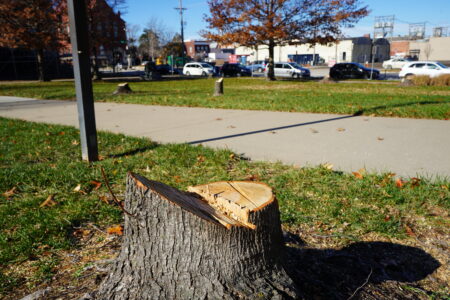
Trees on courthouse lawn cut down; county says they died after irrigation was shut off during renovations
Sleepy, stress-free marsupial will be spreading holiday cheer with Prairie Park Nature Center’s Opossum Grams

Haskell Foundation to host fundraising dinner for university’s athletic programs

City’s 2025 Phoenix Awards honor sculptors, drag performer, Art in the Park organizer and more