Underground survey at historic Beni Israel Cemetery aims to reveal what’s in the subsurface and guide future burials

photo by: Contributed
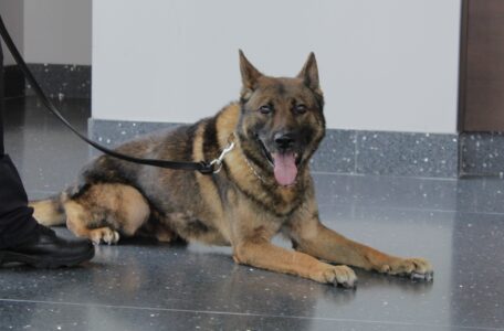
The Kansas Geological Survey conducted a site survey of Beni Israel Cemetery in early April.
An underground survey of Beni Israel Cemetery in Eudora will tell a Jewish congregation what’s below the surface, and how to plan for future burials at the cemetery.
The Lawrence Jewish Community Congregation enlisted Blair Schneider and her team from the Kansas Geological Survey to survey 910 square meters of the historic section of the cemetery using GPS, ground-penetrating radar, also known as GPR, and magnetometry, completing the work in early April.
These tools can guide restoration efforts and are especially valuable in historical cemeteries – like at Beni Israel Cemetery – where records are incomplete.
The LJCC will use the data to place restored markers more accurately; locate genizah sites, which are buried religious texts no longer in use; and potentially locate unmarked graves.
The LJCC will also use the detailed site map from the survey to plan for future burials at the cemetery.
“We’re trying to get everything up to date in the cemetery,” Gigi Wahba told the Journal-World. “If there are unmarked graves, we will do a ceremony for those people, and we will create a monument for them.”
Several German immigrants who founded Eudora in the 1850s were members of a Chicago-based B’nai Israel Jewish congregation. Many early business owners and community leaders in Douglas County belonged to this group and were buried in Eudora’s B’nai Israel Cemetery, even after the congregation relocated to Lawrence. The LJCC reactivated the cemetery in 1978.

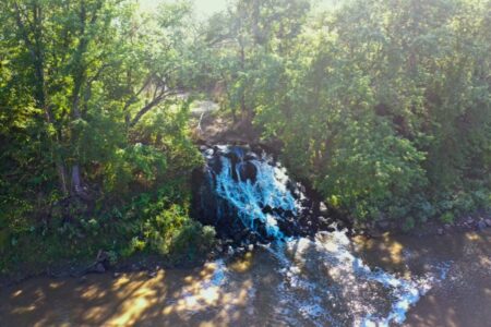
photo by: Contributed
Beni Israel Cemetery
Using GPR and magnetometry in a cemetery can help locate unmarked or forgotten graves, map existing burial plots, and preserve the integrity of the site. GPR is particularly effective at detecting soil disturbances and subsurface voids, which can indicate the presence of graves, while magnetometry can identify buried metal objects like coffin hardware or old markers.
The team from the KGS started with collecting GPS coordinates of all of the trees, headstones, benches, plot markers, genizah and grid boundaries.
“This allows us to place all surface targets within a map to help us understand our data and to guide us as to where/what any anomalies seen in the dataset could be,” Ayla Alves Borges Faria, research assistant at the KGS, said in a press release from the LJCC.
Afterward, the KGS conducted a magnetometry survey, measuring the Earth’s magnetic field, and the final survey was with the GPR and it was completed over four days.
“It’s like a walk-behind, like a lawn mower, and it collects data, but you have to walk every inch of your survey to collect it,” Wahba said. “But there’s a methodology they use … to get all those points.”
This research was funded by an approximately $28,000 grant from the Douglas County Heritage Conservation Council, which was a two-year grant awarded in 2024. The funding has also been used to provide improvements at the cemetery, such as regrading the road, installing new signs, levelling and repairing headstones, adding a bench and offering two fall cemetery tours.
Wahba explained that there could be many reasons why several graves could be unmarked. For example, in Jewish tradition, a person is buried first, and then a monument is typically placed a year later. She mentioned that the congregation is aware of a case where this didn’t happen because the individual that buried them moved away.
Another contributor could be vandalism of the stones, Wahba said. She added that the grave could have been a child buried there, and oftentimes, there were no monuments made for children.
“We just want to know what’s under there because it’s an active use cemetery, and we want to make sure when we go to dig a new grave, we’re not disturbing an old one,” Wahba said.
The LJCC is anticipating to receive the results from the survey at the end of August. The final report is expected to include maps of the area, maps of subsurface activities along with a description of anomalies, with markers on all of the anomalies and describing what could be present.
In the future, the LJCC plans to install a station with a sign featuring photos and QR code in the cemetery that will direct visitors to the LJCC website, where they can learn more about the cemetery’s history.
Other News

A year after Douglas County’s Community Health Improvement Plan rolled out, leaders will give an update on how it’s going

Zombie Walk, library book sale, Schaake’s 50th anniversary, cinema, markets and more
City to temporarily divert Kansas River Wastewater Treatment Plant’s daily flow amid plant improvements

Douglas County Heritage Conservation Council to host town hall to discuss needs of heritage partners
Man finds grenade behind drywall during home renovation