Flyover state: Aerial photography book highlights Kansas geography

The small Kansas town of Liebenthal, just south of Hays, is among the photos included in “Kansas Physiographic Regions: Bird’s-Eye Views” by James and Susan Aber.
Rex Buchanan has spent a good portion of his life trekking around Kansas, looking at its geographic and geologic features.
So when he first saw a new photo of the iconic Monument Rocks in Gove County, a place he’d been many times, it made him pause.
“I first saw the picture they took looking straight down, and I’m not sure I even recognized it at first,” says Buchanan, deputy director of the Kansas Geological Survey at Kansas University. “It’s really interesting to me. It didn’t fit with my mind’s eye of what those things look like.”
That’s exactly what geologists and photographers James and Susan Aber are hoping to accomplish.
The Abers, who teach in Emporia State University’s earth science department, have released “Kansas Physiographic Regions: Bird’s-Eye Views,” a new book of photography and text published by the Kansas Geological Survey.
But don’t let the name fool you: There’s as much, or perhaps more, in here for the public as there is for geologists.
“Aesthetically, I think some of them are really interesting,” Buchanan says. “A nontechnical person can look at them and appreciate them as well. Some of them are just attractive photos to look at. With the standard tag of Kansas being flat, dull, gray and boring, well, not when you sit here and look at these photos.”
For more than a decade, the Abers have used a sort of aerial photography that allows them to get shots from 100 to 500 feet off the ground — lower than airplanes typically fly. They use a remote-controlled camera attached to a kite or small blimp.
“If you have viewed satellite images or were in the window seat on an airplane trip, you have seen the world from a distance,” James Aber says. “It is exciting, but you only see a generalized landscape such as checkerboard patterns of agricultural land use or the empty expanse of the prairies in uniform brown or green areas. Our primary advantage is to reach relatively low heights. We can fly below conventional airplanes and get high-resolution images that show the ground in great detail.”
The book covers a variety of Kansas sites, both natural and man-made. One photo shows the dry bed of the Cimarron River in Morton County, a sign of the dry conditions of western Kansas. Another shows the vibrant-red Gypsum Hills of Barber County.
And others show the interaction between man and nature — Big Brutus, the gigantic shovel that symbolizes the strip mining of southeastern Kansas, or an aerial shot of Liebenthal, a small town south of Hays.
The Abers, who have taken their low-altitude shots around the world, say there’s just as much to learn from them in Kansas as there is in other locales.
“Although most people consider Kansas flat, many portions are quite hilly,” James Aber says. “In fact, several other states are much flatter — Florida, Louisiana, Delaware, etc. Both natural and cultural environments are much more complex than we current understand, which is just as true in Kansas as elsewhere. This complexity is depicted by intricate patterns, textures, associations and relationships that are visible at large scale in our photographs but often not seen on the ground or in conventional air photos or satellite images.”
The Abers say they’re always looking to add to the sites they photograph, and the Arikaree Breaks feature in the northwestern corner of the state is among the locations that are on the to-do list.
For Buchanan, with the Kansas Geological Survey, more photos mean more new perspectives on a state he thought he was familiar with.
“I just think particularly for people who have lived here a long time and think they know the landscape,” he says, “it isn’t often something comes along that makes you think you’re seeing it in a new light.”
Arts and Entertainment

AI helped a musician with Parkinson’s finish his new album when he could no longer play guitar

Go, See, Do: Final Friday Art Walk, City Band concert in the park, markets and more
Go, See, Do: Memorial Day observances, Lawrence Busker Festival, author talks
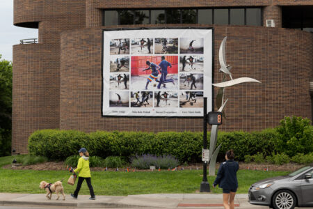
Part of soccer photo collage at Lawrence City Hall was pulled down during storm, but city says it will be back up soon
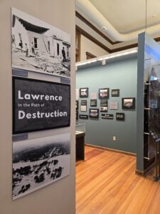
Watkins Museum to open new exhibition marking anniversaries of 1951 Lawrence flood and 1911 tornado
