Corps hints it prefers 32nd route for SLT
Agency wants sound barrier for length of roadway through Baker Wetlands
The U.S. Army Corps of Engineers is inching closer to signing off on a 32nd Street alignment for completion of the South Lawrence Trafficway.
In a letter mailed Wednesday to Mary R. Allman, Kansas’ state historic preservation officer, the corps said concerns about landmark buildings on the Haskell Indian Nations University campus or the historic character of the nearby Baker Wetlands would not stand in the way of the highway being built.
Plans to build a highway to connect Iowa Street with Kansas Highway 10 at Noria Road would have an “adverse” effect on a potential 1,000-acre Haskell historic district, the corps said, but not destroy the district.
The Kansas Department of Transportation simply would need to follow through with previously announced plans to expand the wetlands, relocate 31st Street and push Haskell Avenue and Louisiana Street to the edges of the expanded wetlands, the corps said.
And in a new twist: The state would be required to build walls — on both sides of the highway as it cuts through the wetlands — to muffle traffic noise and block intrusive light.
“We believe that implementation of the minimization and mitigation measures . . . would resolve the adverse impact,” said Col. Donald R. Curtis Jr., the corps’ district engineer.
The ruling — being sent to some 150 governments, organizations and individuals with interests in the trafficway project — is the latest indication that the corps is leaning toward the 32nd Street route as its preferred alignment. A final decision is expected by year’s end.
Opponents of building the trafficway through the wetlands have argued that the road’s traffic, noise, trash and other problems would cause irreparable harm to an area eligible to be designated as a federal historic district.

In his letter, Curtis said that the state’s proposed mitigation plan actually would improve the wetlands’ prospects in relation to anticipated development around them.
By moving Haskell Avenue to the east and Louisiana Street to the west, he said, the expanded wetlands would give the natural area a “permanent buffer” from urban development.
Where the highway would cut through the wetlands, new walls — 12 feet tall facing Haskell Indian Nations University, and 6 feet tall atop a 6-foot-tall berm facing the wetlands — actually would reduce the amount of sound in the area, when compared with what would happen if unchecked development surrounded the area through 2025.
The corps’ other preferred alignment — finishing the highway along a 42nd Street route, running south of the river — also would cause more noise intrusion than the 32nd Street option with noise walls, Curtis said.
Bob Smith, the corps’ project manager for the trafficway, said that both alignments remained in the running.
“It is another step toward the end of the process,” he said.
Bob Johnson, a Douglas County commissioner, said Curtis’ decision was a good sign that the corps would side with supporters of finishing the road along 32nd Street.
“It’s a big hurdle,” he said.
Allman and the national Advisory Council on Historic Preservation will have 30 days to comment on Curtis’ ruling before the corps puts together a formal finding about the project’s effect on the historic properties.
Such input will not be binding.
“Ultimately the corps could say, ‘Thank you very much, but we think this is appropriate,’ ” said Will Banks, an archeologist on Allman’s staff. “Ultimately the decision is theirs, but they arrive at their final decision through consultations.”
City Government

To honor public servants, Lawrence’s July 4 celebration will have a whole gallery of their photos on display; submissions open now

North Lawrence study consultants look at possibilities for a grocery store, food truck park, traffic calming and more

Algerian ambassador gives Lawrence a gift for supporting national team – a piece of art
Lawrence City Commission approves incentives for Alarm.com’s office project in downtown building
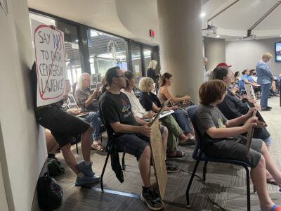
Lawrence City Commission interested in a moratorium on data center development