Photo gallery: KDOT’s new Airspace Awareness Tool
KDOT has developed a new Airspace Awareness Tool, which uses Google Earth to map airspaces. The tool is meant to help with economic development, allowing people to see if tall structures, such as wind turbines, would interfere with Kansas airports’ airspaces.

photo by: Brenna Hawley
Alex Whitten, Eudora High junior, demonstrates KDOT's new Airspace Awareness Tool, which helps people figure out if structures such as wind turbines will interfere with airspace. The program is the first of its kind in the country.
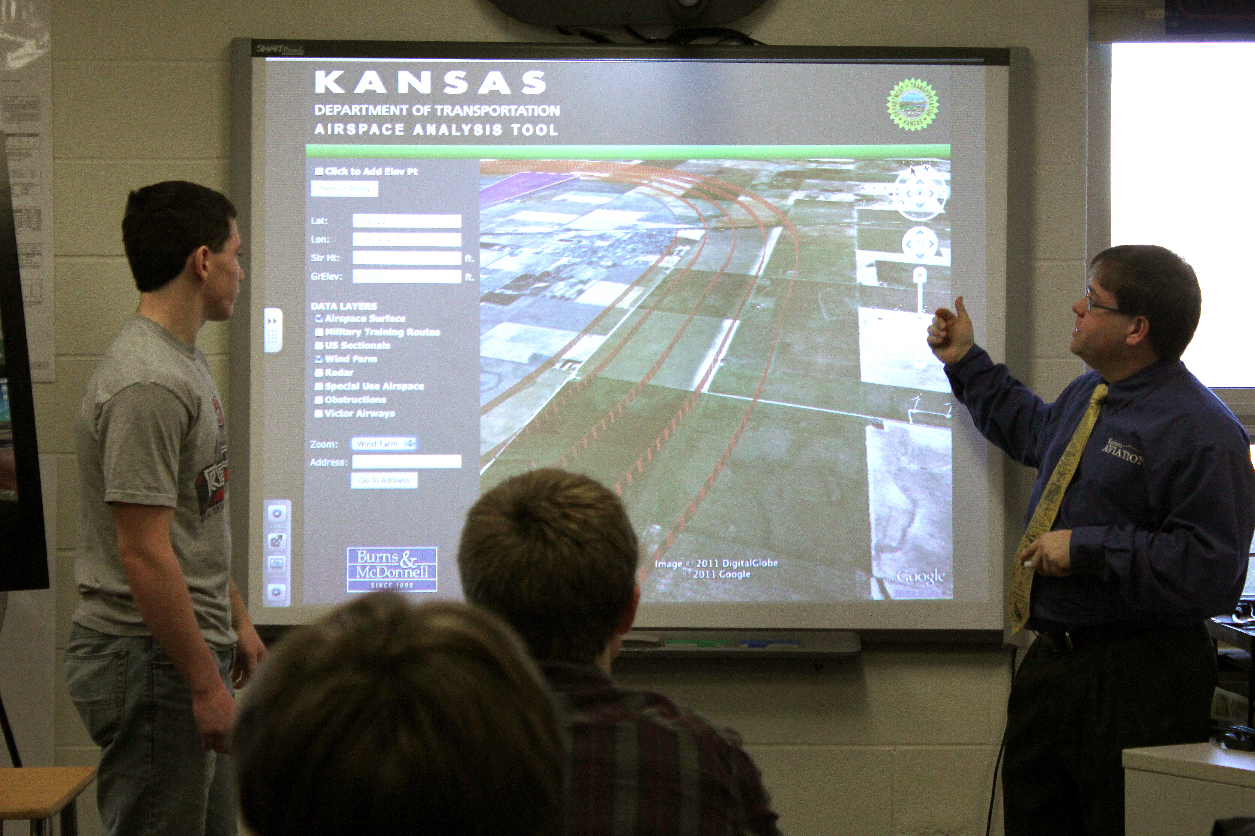
photo by: Brenna Hawley
Alex Whitten, Eudora High junior, left, and Edward Young, president of KDOT's division of aviation, demonstrate a new Airspace Awareness Tool at Eudora High School. The tool uses Google Earth to show airspaces and altitudes needed for taking off in 3D models.
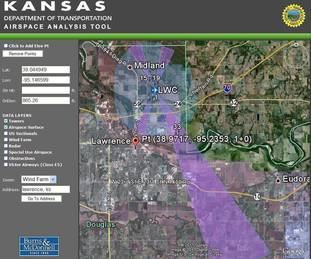
photo by: Edward Young/Special to the Journal-World
A screenshot shows how KDOT's new Airspace Awareness Tool will look. The program uses Google Earth to show airspaces and help people decide where to build tall structures that won't interfere with airspace in Kansas.
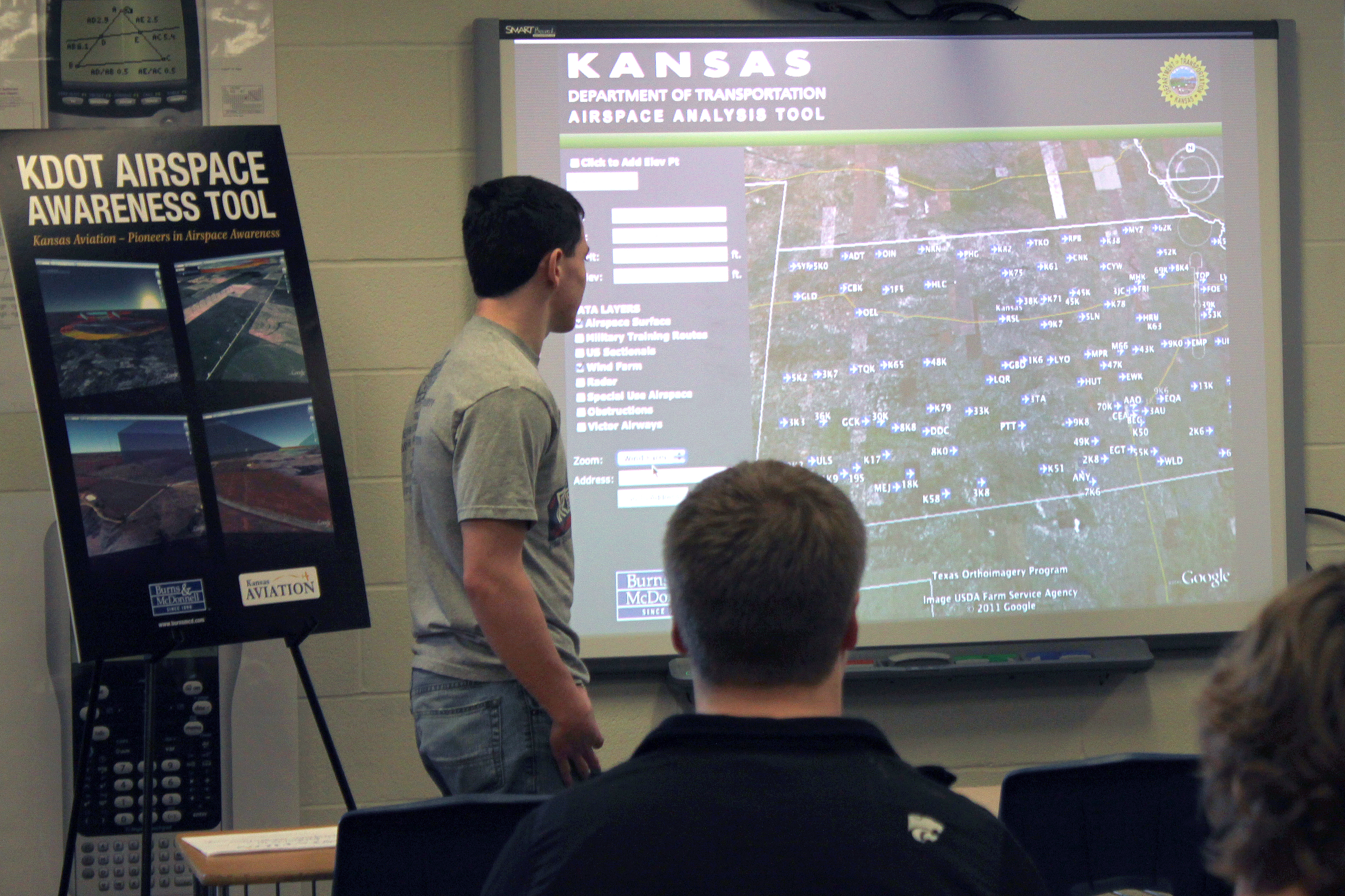
photo by: Brenna Hawley
Eudora High School students watch as Alex Whitten, Eudora High junior, gets ready to use the Kansas Department of Transportation's new Airspace Awareness Tool. The program uses Google Earth to identify airspaces in Kansas and show if structures would be a danger to pilots.
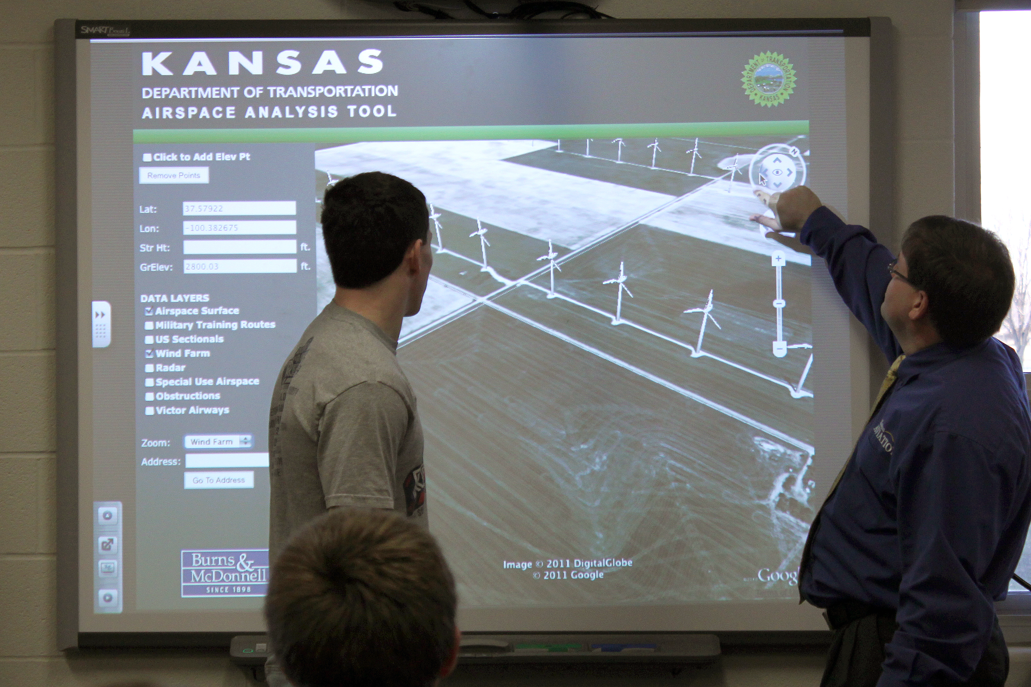
photo by: Brenna Hawley
Alex Whitten, Eudora High junior, left, and Edward Young, president of KDOT's division of aviation, demonstrate a new Airspace Awareness Tool at Eudora High School. The program uses Google Earth to identify airspaces in Kansas and show if structures would be a danger to pilots.
Galleries

Photo Gallery: Wide-ranging KU track and field action on Kansas Relays’ last day

Photo Gallery: KU football hosts Spring Showcase at Rock Chalk Park

Photo Gallery: KU beats Nebraska at third annual Buck O’Neil Classic

Centennial Park’s new skate park addition, a ‘street-style’ plaza, officially opens
